PERSECUTED AND SAVED


ROUTE 04: Port de Tavascan
DESCRIPTION
This route leads to one of the mountain passes used by those fleeing from the Second World War who walked from the French settlements of Ossèse, Ustou and Aulus les Bains, in the region of Ariège, to the Catalan Pyrenees. The Persecuted and Saved project signposts the route refugees followed on foot to the Port de Tavascan pass from the Font de la Casa car park. Trekkers can go there and return following a route that can only be done on foot. From the Tavascan pass, those in search of freedom first followed this route to Tavascan and then continued on to Lleida once within Catalan territory. This is a short stage which gives a taste of what the refugees who crossed the Pyrenees fleeing from the horrors of Nazism must have experienced. The proposed route can be completed in a single stage:
STAGES
STAGE 1: Font de la Costa – Port de Tavascan – Font de la Costa
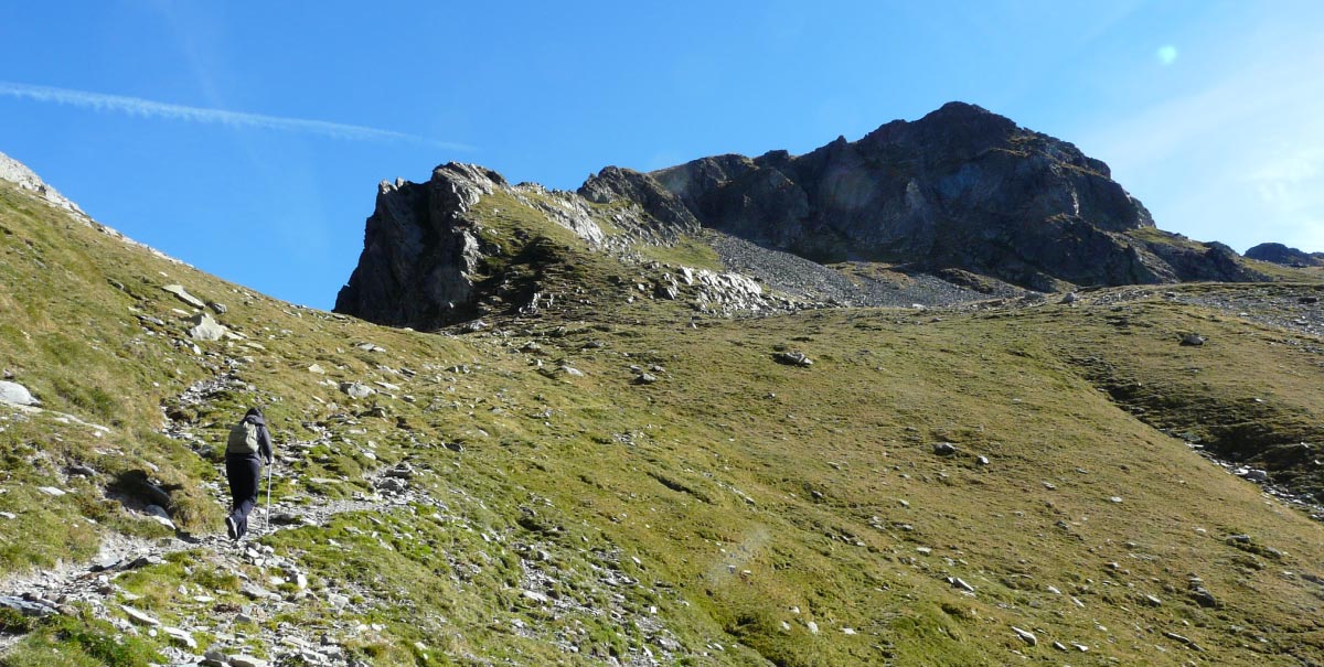
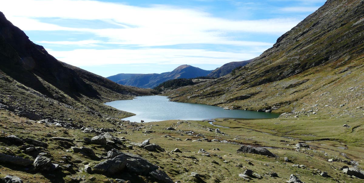
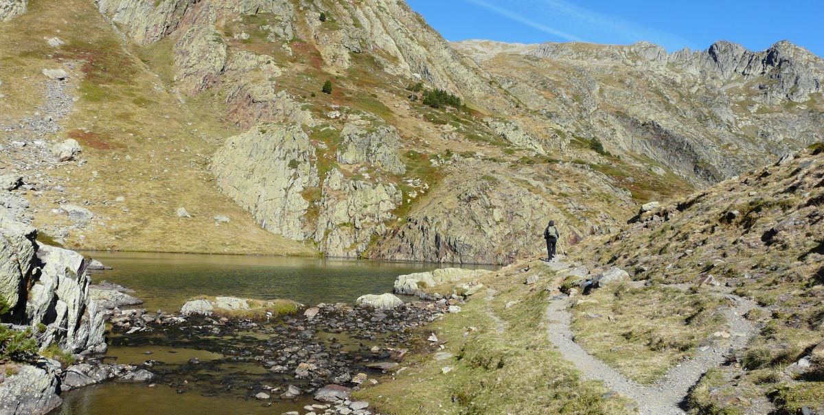
The route begins at the top of the Tavascan pass, at an altitude of 2,218 metres. At the bottom, looking towards France, it is possible to see the Guzet Neige ski resort and the large apartment complex of Prat Matau. This is where the descent from the pass starts. It is an area which tends to be very windy, due to the abrupt changes in temperature that result from marked contrasts between the Atlantic climate of France and the Mediterranean climate of the Catalan Pyrenees. At this point, it is possible to see the Estanys del Port pools down below, without anything to block the fantastic views. In other words, these pools stand to one side of the great hydro-electric network that was built in the Cardós Valley in the last century. This is also one of the settings for the successful novel by Ramon Solsona entitled “Allò que va passar a Cardós” (What happened at Cardós). After following the red and white markings of the GR for about 30 minutes, trekkers will come to the foot of the first pool. From there, it is possible to see the 2,618-metre-high Montarenyo peak, off to the right, and the 2,781-metre-high Flamisella, to the left. Continuing along path that skirts the pool along its left-hand side, walkers will reach the Estany Xic (small pool) after about 15 minutes. There, it is possible to find a small, unmanned, mountain shelter, which can be used in cases of necessity. After the Estany Xic, there is a zigzag descent along which trekkers will almost certainly encounter flocks of the animals. They usually enjoy the pasture here from spring until autumn. To the left, it is possible to see the results of the harsh climatology that trees must endure at these altitudes. It is also possible to observe the effects of the avalanches that take place in this steeply sloping area of the Pyrenees in winter and spring and to imagine how difficult it must have been for all those people who walked along this route during the Spanish Civil War and the Second World War, particularly in winter. The route runs through one of the most emblematic valleys in the High Pyrenees Natural Park: the Cardós Valley. It can only be done on foot, although it is possible to use a mountain bike (MTB) or 4×4 vehicle to get from Tavascan to the car park at Font de la Costa.
TECHNICAL DETAILS
Stage 1: Port de Tavascan – Font de la Costa
Start point: Tavascan Pass
End point: Font de la Costa
Total length: 2.8 km (one way) – 5.6 km (return journey)
Initial altitude at the Tavascan Pass: 2.218 m
Final altitude at Font de la Costa: 1.809 m.
Net ascent: 409 m.
Difficulty: MODERATE
Duration: 1 h 45 min ascent – 1 h descent
Whole route: 2 hours 45 minutes + time for stops.
ACCESS POINTS
As far as Font de la Costa (Cardós Valley – El Pallars Sobirà):
It is 34 km from Sort to the village of Tavascan (Cardós Valley). Once at the village, head to the Pleta del Prat mountain shelter. This route enters one of the most spectacular landscapes in the High Pyrenees, which is scattered with “bordes” (rural buildings) that provided shelter for those fleeing the wars. Soon after, trekkers will arrive at Bordes de Grau. Here, there is now a camp site next to the Graus reservoir, which supplies the hydro-electric power station of Tavascan. Then, 6 km further along, lie the Bordes de Quanca, off to the left. To the right, there is a turn off from the forest track that leads to the Estanys del Port pools. This 5 km section, which runs as far as the car park at La Font de la Costa spring, must be done using a 4×4 vehicle, on foot, or by mountain bike (MTB). It takes visitors to the start of the walking route that goes on to the Port de Tavascan pass. For those who like variety, on the way back, just a short distance from the spring, there is a turn off which leads to Bordes de Noarre, which was another of the hiding places used by those escaping the war. At this point, trekkers are only about a 15-minute walk from the forest track.
RECOMMENDATIONS TO FOLLOWING THE ROUTE
Doing the route is conditioned by its state, which varies according to the different seasons of the year. It is recommended to do it in SUMMER – AUTUMN. At the end of the pass, it is often quite windy. It is therefore recommended to wear warm clothing, regardless of the time of year.
- Hiking poles.
- Mountain footwear.
- 5 litres of water per person.
- Solar protection (glasses, cap, etc.)
- Wear appropriate clothing (warm clothes in case of cold, and waterproofs in case of rain).
- Take enough food for a whole day.
- Go with other people and, whenever possible, with guides who know the territory.
Get information about the meteorological conditions and about the path before starting the route.
SPACES OF INTEREST
El Pallars Sobirà – and especially the Cardós Valley, which is located in the heart of the High Pyrenees Natural Park – has numerous natural, cultural and sporting tourist resources to enjoy all year round. It is relevant to highlight those that can be found along the route or that it is recommended to visit on account of their relation with its main theme:
“Road to Freedom” Prison Museum, at Sort
A prison centre for more than 2,660 people who were detained during their flight through the Pyrenees during the period corresponding to the Second World War.
Tel. 973620010
www.camidelallibertat.cat
museu@camidelallibertat.cat
Bordes de Noarre
These rural buildings were used as places of refuge by those fleeing from France.
TOURIST SERVICES
In El Pallars Sobirà, it is possible to find a wide variety of tourist establishments. Here, we highlight the accommodation and bar-restaurants which are located nearest to the walking route.
At Tavascan there are rural houses, hotels and restaurants.
For more information contact:
http://turisme.pallarssobira.cat/
THE WHOLE ROUTE FROM FRANCE: Cabanes d’Ossese – Port de Tavascan – Font de la Costa Car Park
Anyone who wants to do the whole historic route must start it in France and walk through the Ariegeoises Pyrenees Natural Park. This is a long and demanding walk, but one that is apt for people who are used to doing mountain crossings.
Route: Cabanes d’Ossèse – Font de la Costa
The reference settlement in France is Ossèse. From there, it is necessary to follow a tarmac road as far as a small nucleus of shelters known as Cabanes d’Ossèse.
The route can be done in a single 6-hour walk, allowing extra time for stops. It is necessary to bear in mind that 5 hours of this time will be required for the climb up from France. There is then a 1-hour descent from the Tavascan pass to Font de la Costa, where it is possible to arrange to be picked up by a 4×4 vehicle.
Visitors are recommended to visit the “Road to Freedom” Prison-Museum before leaving El Pallars Sobirà.
