PERSECUTED AND SAVED


ROUTE 05: Port de Cabús
DESCRIPTION
The Persecuted and Saved project has signposted this route from Alins, in the heart of the Farrera Valley, to the Port de Cabús pass on the border with Andorra. It is a route that follows a road and a forest track which is not suitable for normal road vehicles. It crosses the Tor Valley, which is a sub-valley of the Farrera Valley that conserves all the charm of the most authentic Pyrenean territory, passing through an area where time seems to have stood still. This starkly contrasts with the highly exploited neighbouring Andorra. Tor is the second highest settlement in Catalonia, standing at an altitude of 1,649 metres. Over the years, the harsh meteorological conditions to which this area is submitted during the winter months and the harsh nature of life in this area have resulted in its depopulation. However, on the positive side, this has helped to maintain its authenticity and enabled with it to remain free from the pressures of urban development. This is a precious Pyrenean setting which allows us to relive history, just as it was experienced by the people who secretly passed over the international frontier in search of freedom in the mid-20th century. Now, however, it is more accessible, particularly by 4×4 vehicle. The proposed route can be completed in a single stage as explained below:
STAGES
STAGE 1: Alins – Tor – Port de Cabús – Tor – Alins
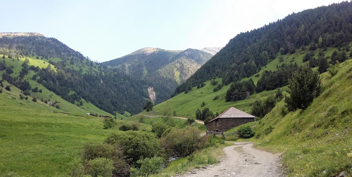
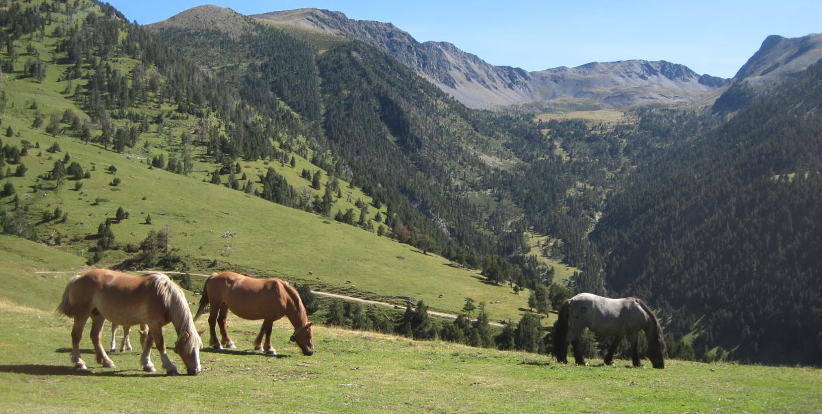
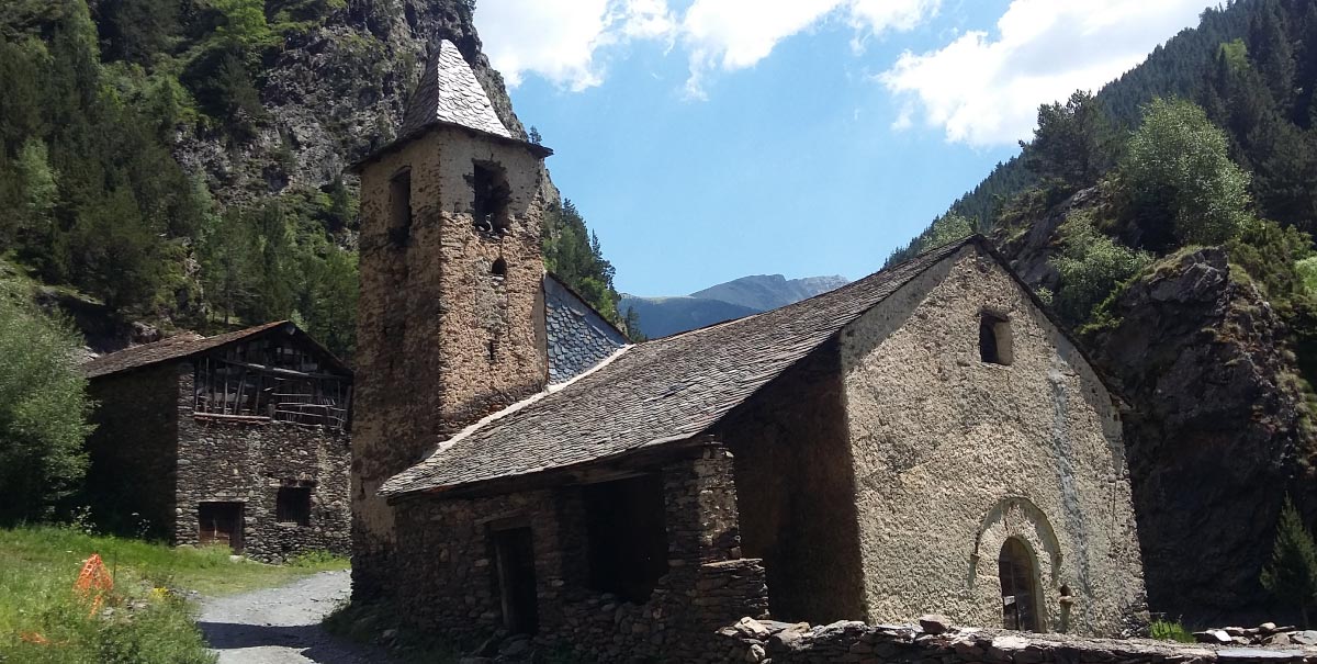
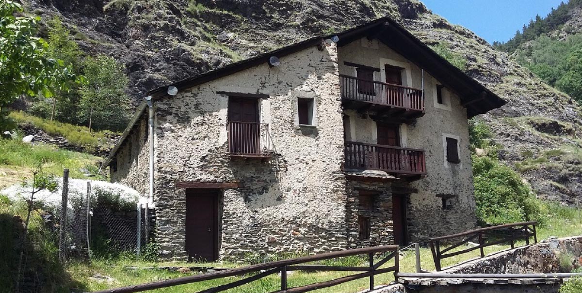
The route begins at Alins, the capital of the municipal area of the same name, where the local council building and several tourist services stand next to the road. On leaving the village, it is necessary to turn off to the right a follow the signposted route marked Tor – Norís. The road rapidly gains altitude as it leaves Alins below as it runs through the narrow entrance to the Tor Valley. This is a tarmac forest track, so it is necessary to drive with care. The speed limit is 30 km/h as it is located in the middle of the High Pyrenees Natural Park. The road is accompanied by the River Noguera de Tor along part of the way and crosses it several times. At about 4 km from Alins, there is the turn off for Norís, while the main road continues on towards Tor. It is possible to note how the valley grows increasingly narrow as the route ascends. The landscape also begins to change, passing from typical Pyrenean riverside scenery to that of black pine and fir forests. At 10 km from Alins, and just after crossing the river via a concrete bridge, the tarmac section of the road comes to an end. From this point on, it runs through private property belonging to the “Sociedad de Condueños de Propietarios de la Montaña de Tor” (Society of the Co-owners of the Mountain of Tor). This company was founded in 1896, causing the property dispute that is explained in a best-selling novel by Carles Porta: “Tor, tretze cases i tres morts” (Tor, thirteen houses and three deaths). After 2 km more of the forest track, the route reaches Tor, which is an obligatory stopping point. Here it is possible to note the special charm of this small hamlet formed by thirteen houses, where the locals live from forestry, herding and agriculture. Taking advantage of the strong water current, the settlement once had two flour mills, as noted by Madoz in a work dating from 1845. Tor represents a real journey back into the past and to a time of considerable economic prosperity for this area. This can be appreciated from the size and height of its houses, which were constructed at the beginning of the 19th century, and it is explained in some of the inscriptions made on the stonework of their façades. Here, it is also possible to visit the Romanesque-style church of Sant Pere. In the past, Tor also had a castle, of which almost nothing now remains, while the Church of Sant Ambrós, was of Visigoth origin. Continuing along the route, it is necessary to cross the settlement and head for the Port de Cabús pass. The Rabasta Valley then opens out in front of visitors to reveal its splendid meadows and mountain shelters. After crossing the River Borts, or the gully down which it flows, which presents no problems for a 4×4 vehicle, visitors should follow the track that leads in the direction of the Roc de Llumeneres, which is another obligatory stopping point. It must be remembered that this route passes through a Natural Park and that any off-road wheeled vehicle transport is strictly forbidden. It is therefore recommended to park at this point and climb up to the Roc de Llumeneres on foot in order to enjoy the views over the valley. At this point, there is a junction with another forest track, which can be followed on the way back. For the moment, there are still another 3 km before visitors reach the top of the Port de Cabús pass. At the top, they are in Andorra and there is the start of a wide, tarmac road. There is a tremendous, and easy to note, contrast between the Tor Valley, which remains almost completely untouched, and the great infrastructure and installations of the Andorran winter nucleus of Vallnord. To return, it is necessary to go back to Roc de Llumeneres, but this time, visitors can turn off to the right and then head down through the Pleià Valley as far as Tor. By doing this, they will complete a circular route around the Roc de Llumeneres. At the bottom of the Pleià Valley lies the Cova de Sansa. This was a hippy settlement that dates from the 1980s and the time of the dispute over the ownership of the mountain. It is still possible to make out some of its remains. Once at Tor, head back to Alins by retracing the initial path.
TECHNICAL DETAILS (by 4×4)
Start point: Alins
End point: Alins
Total length: 36 km.
Altitude of Alins: 1,048 m
Altitude of Port de Cabús: 2,306 m
Approximate time: 3 hours + time for stops.
ACCESS POINTS
As far as Alins (Vall Farrera – El Pallars Sobirà)
The settlement is 27 km from Sort and 13 km from Llavorsí.
To get to Alins, it is necessary to first go to Llavorsí, following the C-13, and to then take the turn off for Alins: L-504. After about 3 km, visitors will reach a roundabout where they must turn off to the right and follow the L-510 to Alins.
RECOMMENDATIONS FOR FOLLOWING THE ROUTE
It is recommended to do this route by MTB or 4×4, starting from Alins. Road traffic is strictly regulated within this natural setting and no unauthorised convoys of more than 4 vehicles are permitted. If necessary, visitors should ask for permission from the Consell Comarcal of El Pallars Sobirà and this must be approved by the High Pyrenees Natural Park. In winter, road traffic is prohibited (while there is snow on the tracks); it is therefore recommended to do this route between June and October. Although this is a route for vehicles, we recommend visitors to bring appropriate warm clothing for each period of the year; the pass is at an altitude of 2,306 metres and it is often quite cool here, even in the height of summer.
Furthermore, visitors should always get information about the weather conditions and the state of the roads before beginning this route.
SPACES OF INTEREST
El Pallars Sobirà, and more specifically the Farrera Valley, has numerous natural, cultural and sporting tourist resources to enjoy all year round. It is relevant to highlight those that can be found along the route or that it is recommended to visit on account of their relation with the main theme:
“Road to Freedom” Prison Museum, at Sort
A prison centre for more than 2,660 people who were captured and detained when fleeing through the Pyrenees during the Second World War.
Tel. 973620010. Web
www.camidelallibertat.cat
Tor
Picturesque hamlet in the Farrera Valley; the second highest settlement in Catalonia.
Serradora d’Àreu
Tel. 973 62 44 17 / 973 62 44 05.
Web http://www.serradora-areu.org
TOURIST SERVICES
In El Pallars Sobirà, it is possible to find a wide variety of tourist establishments. Here, we highlight the accommodation and bar-restaurants that can be found along or near the route. At Alins, it is possible to find hotels, camp sites, rural houses and restaurants.
For more information contact:
